System 01
Search route planning
Coverage lanes, altitude, search zones, mission stages, and revisit points can be planned before launch and adjusted under operator supervision as field information changes.
search and rescue drone
Combine structured search coverage, thermal detection, onboard AI, telemetry, and payload support to assist trained response teams.
Mission capability
Aeroniti configures search and rescue drone missions using thermal camera detection, route coverage, onboard AI, telemetry, payload support, and operator-supervised autonomy.
How the system works
Each layer is configured around the aircraft, operating environment, sensor stack, safety requirements, and level of human supervision.
Coverage lanes, altitude, search zones, mission stages, and revisit points can be planned before launch and adjusted under operator supervision as field information changes.
Thermal sensing and onboard inference can highlight possible human heat signatures for operator review, especially when visible-light imagery is limited.
Aerial observation can help response teams examine inaccessible or low-visibility areas while maintaining a live telemetry and video link where communications permit.
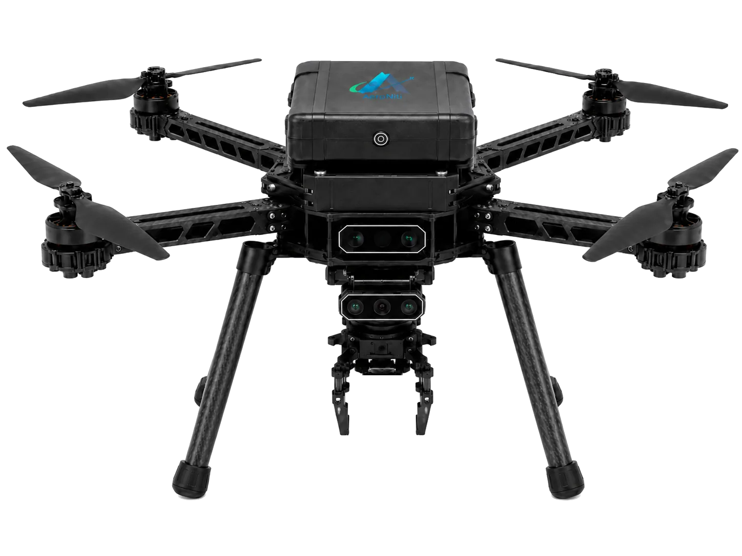
A configured gripper or release mechanism can support controlled delivery of lightweight emergency supplies when payload limits, permissions, and conditions allow.
Route history, imagery, detections, and telemetry can help teams review covered areas, coordinate follow-up activity, and preserve operational evidence.
Search detections are decision-support signals, not guaranteed findings. Trained responders retain responsibility for validation, mission changes, safety, and field action.
Frequently asked questions
Practical answers for teams assessing an Aeroniti mission configuration.
A drone can help cover planned search areas, stream aerial imagery, highlight possible thermal detections, record telemetry, and carry a suitable lightweight payload.
Thermal cameras can reveal heat contrast at night, but range, terrain, weather, occlusion, and sensor resolution affect results.
A suitable aircraft and payload mechanism can support controlled delivery within tested payload, safety, and regulatory limits.
No. AI assists with detection and mission information; trained operators and response personnel validate findings and direct the mission.
Yes. Stored route, imagery, timestamps, detections, and telemetry can support mission review and follow-up planning.
Request demo
Share the mission, aircraft, operating environment, sensors, payload, safety constraints, and expected outcome. Aeroniti can define a focused integration and field-validation path.