LiDAR · Obstacle Awareness · Sensor Fusion
LiDAR Obstacle Avoidance for Drones
By Aeroniti Engineering · Published 2026-07-19 · Updated 2026-07-19
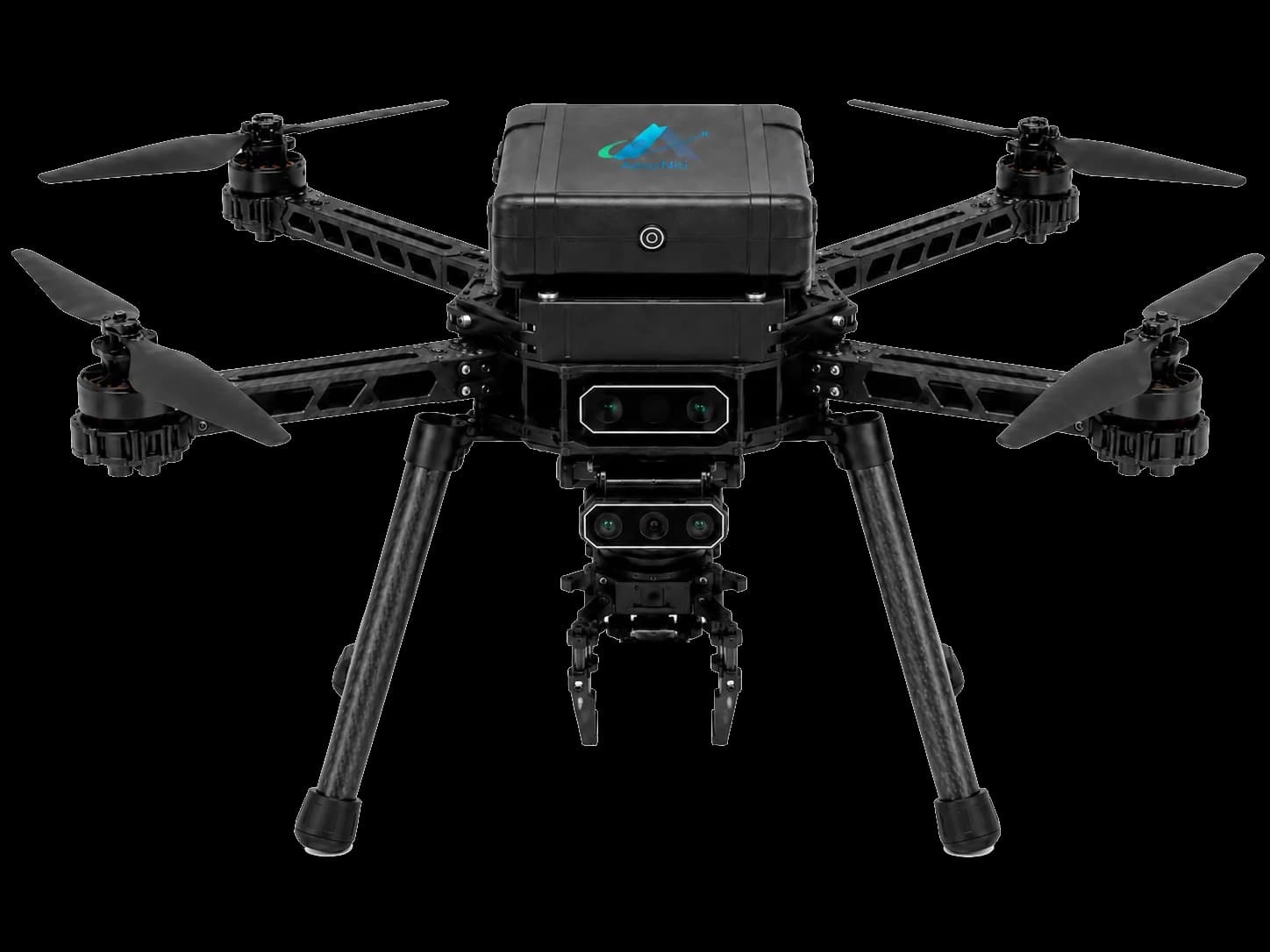
LiDAR measures distance by emitting light and observing its return. On a drone, those measurements can support obstacle awareness beyond what a single forward camera sees. A 360-degree sensor may create a broader horizontal view, while scanning or solid-state designs offer different range, resolution, field-of-view, weight, and power tradeoffs.
Obstacle avoidance is not delivered by the sensor alone. The system must timestamp and transform points, filter noise, represent free and occupied space, account for vehicle size and motion, choose a bounded response, and request that response through the flight controller. Weather, reflectivity, thin objects, speed, vibration, and sensor placement remain important limits.
Architecture flow
The following simplified flow shows where information is interpreted and where flight-safe execution remains separated. Actual interfaces, rates, redundancy, and authority depend on the aircraft and mission.
What LiDAR obstacle avoidance drone means in practice
A LiDAR obstacle avoidance drone uses range measurements as an input to onboard environmental reasoning. The autonomy layer estimates clearance and requests a hold, slow-down, reroute, climb, or other tested response, while Pixhawk and ArduPilot retain stabilization and flight-safety responsibilities.
01 — LiDAR sensor
produces range samples with a defined field of view, resolution, scan rate, and usable range For LiDAR obstacle avoidance drone, verify this against the aircraft, mission objective, compute budget, sensors, communication link, and flight-safety boundary.
02 — State estimate
supplies vehicle attitude, position, velocity, and timing needed to interpret moving point data For LiDAR obstacle avoidance drone, verify this against the aircraft, mission objective, compute budget, sensors, communication link, and flight-safety boundary.
03 — Local representation
converts samples into sectors, point clouds, occupancy, distance fields, or another decision-ready form For LiDAR obstacle avoidance drone, verify this against the aircraft, mission objective, compute budget, sensors, communication link, and flight-safety boundary.
04 — Planner or rule engine
compares predicted motion and clearance against tested operating limits For LiDAR obstacle avoidance drone, verify this against the aircraft, mission objective, compute budget, sensors, communication link, and flight-safety boundary.
Architecture and component responsibilities
A useful architecture assigns each component a narrow responsibility and makes every authority transition visible. For LiDAR obstacle avoidance drone, system quality depends less on one device than on how data, commands, acknowledgements, and failures move between components.
01 — Time alignment
each scan needs a consistent timestamp relative to vehicle motion and other sensors For LiDAR obstacle avoidance drone, verify this against message ownership, update rate, latency, stale-data handling, command acknowledgement, and operator authority.
02 — Coordinate transforms
sensor mounting geometry must map measurements into body, local, or map frames For LiDAR obstacle avoidance drone, verify this against message ownership, update rate, latency, stale-data handling, command acknowledgement, and operator authority.
03 — Autopilot request
avoidance logic needs a supported mode, bounded setpoint, acknowledgement, and timeout For LiDAR obstacle avoidance drone, verify this against message ownership, update rate, latency, stale-data handling, command acknowledgement, and operator authority.
04 — Ground visibility
operators need sensor health, closest obstacles, selected response, and degraded-state alerts For LiDAR obstacle avoidance drone, verify this against message ownership, update rate, latency, stale-data handling, command acknowledgement, and operator authority.
End-to-end operating workflow
The workflow should describe the system from mission preparation through execution and recovery. The sequence below is deliberately operational: it connects software behavior with checks that an engineering team and an operator can observe.
01 — Sense
collect range data and reject invalid, saturated, out-of-range, or stale samples For LiDAR obstacle avoidance drone, verify this against mission state, pre-flight readiness, environmental conditions, flight mode, telemetry freshness, and the defined recovery path.
02 — Transform
compensate for mounting orientation and vehicle motion before combining measurements For LiDAR obstacle avoidance drone, verify this against mission state, pre-flight readiness, environmental conditions, flight mode, telemetry freshness, and the defined recovery path.
03 — Assess
evaluate clearance around the current path with vehicle dimensions, stopping distance, and uncertainty margin For LiDAR obstacle avoidance drone, verify this against mission state, pre-flight readiness, environmental conditions, flight mode, telemetry freshness, and the defined recovery path.
04 — Respond
request a tested hold, speed reduction, alternate path, or operator handover through the autopilot For LiDAR obstacle avoidance drone, verify this against mission state, pre-flight readiness, environmental conditions, flight mode, telemetry freshness, and the defined recovery path.
Engineering design considerations
A technically credible system is built around constraints rather than ideal demonstrations. These considerations shape hardware selection, software boundaries, test coverage, and the conditions under which the capability should or should not be enabled.
01 — Sensor placement
airframe, landing gear, payload, propellers, and cables can block or contaminate the field of view For LiDAR obstacle avoidance drone, verify this against power, mass, thermal limits, vibration, electromagnetic compatibility, timing, maintainability, and safe degradation.
02 — Dynamic margin
safe clearance depends on velocity, braking ability, control latency, wind, and route geometry For LiDAR obstacle avoidance drone, verify this against power, mass, thermal limits, vibration, electromagnetic compatibility, timing, maintainability, and safe degradation.
03 — Compute budget
point processing and mapping must remain timely alongside perception, recording, and communication For LiDAR obstacle avoidance drone, verify this against power, mass, thermal limits, vibration, electromagnetic compatibility, timing, maintainability, and safe degradation.
04 — Fusion strategy
cameras or depth sensors may add classification and close-range context that LiDAR alone lacks For LiDAR obstacle avoidance drone, verify this against power, mass, thermal limits, vibration, electromagnetic compatibility, timing, maintainability, and safe degradation.
Limitations and failure modes
No autonomy or sensing capability should be presented as certain in every environment. Identifying limitations early prevents a promising prototype from becoming an unsafe or unreliable field workflow.
01 — Surface response
dark, reflective, transparent, thin, angled, or low-return objects may produce weak measurements For LiDAR obstacle avoidance drone, verify this against sensor uncertainty, occlusion, weather, range, vehicle dynamics, communications, human factors, and regulatory operating limits.
02 — Atmosphere
rain, fog, dust, and direct sunlight can affect different LiDAR designs in different ways For LiDAR obstacle avoidance drone, verify this against sensor uncertainty, occlusion, weather, range, vehicle dynamics, communications, human factors, and regulatory operating limits.
03 — Coverage gaps
a horizontal scanner may not see obstacles above, below, or within occluded sectors For LiDAR obstacle avoidance drone, verify this against sensor uncertainty, occlusion, weather, range, vehicle dynamics, communications, human factors, and regulatory operating limits.
04 — Moving scenes
obstacles and vehicle motion can make old point clouds misleading without freshness and tracking For LiDAR obstacle avoidance drone, verify this against sensor uncertainty, occlusion, weather, range, vehicle dynamics, communications, human factors, and regulatory operating limits.
Verification before flight
Verification should progress from repeatable software tests to integrated hardware and controlled flight. Passing a nominal demonstration is only one result; the team must also test missing, delayed, contradictory, and out-of-range inputs.
01 — Static targets
measure detection and clearance estimates across material, size, angle, range, and field of view For LiDAR obstacle avoidance drone, verify this against acceptance criteria, traceable logs, repeatability, safe abort behavior, manual override, and evidence that each fallback occurs within its allowed time.
02 — Motion tests
evaluate latency and stopping margin at representative aircraft speeds and approach directions For LiDAR obstacle avoidance drone, verify this against acceptance criteria, traceable logs, repeatability, safe abort behavior, manual override, and evidence that each fallback occurs within its allowed time.
03 — Fault injection
block sectors, delay scans, restart the sensor, and introduce invalid data while observing fallback For LiDAR obstacle avoidance drone, verify this against acceptance criteria, traceable logs, repeatability, safe abort behavior, manual override, and evidence that each fallback occurs within its allowed time.
04 — Controlled flight
progress from large obvious obstacles to mission geometry without claiming universal collision prevention For LiDAR obstacle avoidance drone, verify this against acceptance criteria, traceable logs, repeatability, safe abort behavior, manual override, and evidence that each fallback occurs within its allowed time.
Deployment and operator supervision
Field deployment combines the technical system with procedures, permissions, training, maintenance, and review. Human supervision is most effective when the interface explains what the aircraft is doing, why it is doing it, and which intervention remains available.
01 — Pre-flight inspection
confirm lens cleanliness, mounting, vibration isolation, cable retention, and health status For LiDAR obstacle avoidance drone, verify this against site authorization, checklists, crew roles, data handling, maintenance intervals, incident review, and change control.
02 — Mission constraints
define maximum speed, clearance, weather, route, and permitted avoidance actions For LiDAR obstacle avoidance drone, verify this against site authorization, checklists, crew roles, data handling, maintenance intervals, incident review, and change control.
03 — Live supervision
show whether avoidance is healthy, degraded, active, or unavailable For LiDAR obstacle avoidance drone, verify this against site authorization, checklists, crew roles, data handling, maintenance intervals, incident review, and change control.
04 — Post-flight review
correlate point data, decisions, autopilot response, path, video, and operator action For LiDAR obstacle avoidance drone, verify this against site authorization, checklists, crew roles, data handling, maintenance intervals, incident review, and change control.
Frequently asked questions
These concise answers summarize common engineering questions. They do not replace the selected hardware documentation, flight testing, operating approval, or a mission-specific safety assessment.
Can LiDAR prevent every drone collision?
No. Detection and avoidance depend on coverage, target properties, weather, speed, processing, control response, and testing.
Why use 360-degree LiDAR?
It can provide broader horizontal range awareness than a single forward-facing sensor.
Does LiDAR work in rain or fog?
Performance varies by sensor and conditions; adverse weather requires specific evaluation and operating limits.
Does LiDAR control the motors?
No. It informs autonomy software, while Pixhawk and ArduPilot execute supported flight behavior.
Should LiDAR be combined with cameras?
Often yes. Cameras add visual context while LiDAR supplies direct range measurements.
Continue with Aeroniti engineering resources
Explore the related product and solution architecture, or bring Aeroniti a specific aircraft, sensor, payload, mission, and operating constraint for a focused technical discussion.